9 B MAPLE LANE
Owner Information
PERRY DONALD J
15 RUSSELL ST
HULL, MA 02045-0000


Property Details
9 B MAPLE LANE is classified as a Single Family Residential (Col/old styl).
The primary structure on this property was built in 1892. There are 1,440ft2 of built area within this property. There is 1,440ft2 of residential/living space within this property. This property is listed as having 6 rooms.
9 B MAPLE LANE is valued at $374,800. The land is valued at $166,600 and the structures are valued at $208,200.
This property is in Zone SFB. Confirm with local Zoning Board authorities to ensure there are no overlays or other easements on this property.
The most recent deed for 9 B MAPLE LANE is recorded at the local registrar in Book 14143, Page 329. 9 B MAPLE LANE was last sold on Friday, February 16, 1996 for $31,500.
Assessment data from fiscal year 2022.
Flood Data
According to the FEMA National Flood Hazard Layer, this property does not appear to be in a flood zone. It may also be in an area not yet reviewed. Nonetheless, confirm this information prior to taking any action.
To view the flood hazards around this property, create a FEMA "Firmette" Map of the area around 9 B MAPLE LANE.
Broadband Internet Providers
| Provider | Type | Bandwidth (mbps) | |
|---|---|---|---|
| VSAT Systems, LLC. | Satellite | 2 | 1 |
| Verizon New England Inc. | DSL | 1 | 0 |
| Viasat Inc | Satellite | 100 | 3 |
| Comcast | Cable | 1000 | 35 |
| GCI Communication Corp. | Satellite | 0 | 0 |
| Verizon New England Inc. | Fiber | 940 | 880 |
| HughesNet | Satellite | 25 | 3 |
Broadband service provider data from December 2020.
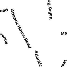
Adjacent Properties
- 9 A MAPLE LANE
Single Family Residential owned by MALNATI LINDA S - 9 MAPLE LANE
Single Family Residential owned by COOPER NANCY - 8 MAPLE LANE
Single Family Residential owned by MUCCINI FRANK & PHYLLIS - 12 MAPLE LANE
Single Family Residential owned by WILLIAMS CHARLES - 22 R VALLEY BEACH AVE
Single Family Residential owned by ALLEN CHARLES J