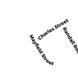
0 CHARLES ST
Owner Information
HOUCK DOROTHY A
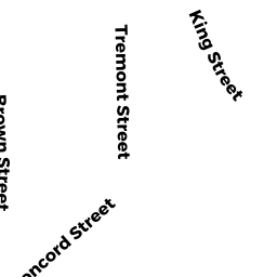
34 CONCORD ST
MAYNARD, MA 01754


Property Details
0 CHARLES ST is classified as a Undevelopable Residential Land.
0 CHARLES ST is valued at $19,400. The land is valued at $19,400 and the structures are valued at $0.
This property is in Zone R1. Confirm with local Zoning Board authorities to ensure there are no overlays or other easements on this property.
The most recent deed for 0 CHARLES ST is recorded at the local registrar in Book 13517, Page 405. 0 CHARLES ST was last sold on Thursday, August 17, 1978 for $55,000.
Assessment data from fiscal year 2022.
Flood Data
According to the FEMA National Flood Hazard Layer, this property does not appear to be in a flood zone. It may also be in an area not yet reviewed. Nonetheless, confirm this information prior to taking any action.
To view the flood hazards around this property, create a FEMA "Firmette" Map of the area around 0 CHARLES ST.
Broadband Internet Providers
| Provider | Type | Bandwidth (mbps) | |
|---|---|---|---|
| Verizon New England Inc. | DSL | 15 | 1 |
| Comcast | Cable | 1000 | 35 |
| T-Mobile | Fixed Wireless | 25 | 3 |
| GCI Communication Corp. | Satellite | 0 | 0 |
| HughesNet | Satellite | 25 | 3 |
| VSAT Systems, LLC. | Satellite | 2 | 1 |
| Viasat Inc | Satellite | 100 | 3 |
| Crown Castle Fiber | Fiber | 0 | 0 |
| Verizon New England Inc. | Fiber | 940 | 880 |
Broadband service provider data from December 2020.
Adjacent Properties
- 0 CHARLES ST EXT
(formerly Municipalities/Districts. Removed June 2009.) owned by TOWN OF MAYNARD - 74 ACTON ST
Electricity Regulating Substations owned by NSTAR ELECTRIC COMPANY - 40 CONCORD ST
Single Family Residential owned by DAWSON TR - 38 CONCORD ST
Two-Family Residential owned by MARKHAM RLTY TR - 0 CHARLES ST
Undevelopable Residential Land owned by HOUCK DOROTHY A - 68 - 70 ACTON ST
Two-Family Residential owned by HEATH, EILEEN M