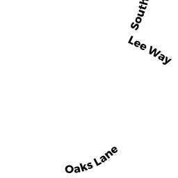
115 SOUTH ST
Owner Information
FORD TIMOTHY E
115 SOUTH ST
ROCKPORT, MA 1966


Property Details
115 SOUTH ST is classified as a Single Family Residential (Colonial).
The primary structure on this property was built in 1971. There are 2,520ft2 of built area within this property. There is 1,344ft2 of residential/living space within this property. This property is listed as having 5 rooms.
115 SOUTH ST is valued at $404,600. The land is valued at $320,300 and the structures are valued at $79,000. There is an additional valuation of $5,300 on this property.
This property is in Zone R1. Confirm with local Zoning Board authorities to ensure there are no overlays or other easements on this property.
The most recent deed for 115 SOUTH ST is recorded at the local registrar in Book 35402, Page 530. 115 SOUTH ST was last sold on Monday, October 31, 2016 for $1.
Assessment data from fiscal year 2021.
Flood Data
According to the FEMA National Flood Hazard Layer, this property does not appear to be in a flood zone. It may also be in an area not yet reviewed. Nonetheless, confirm this information prior to taking any action.
To view the flood hazards around this property, create a FEMA "Firmette" Map of the area around 115 SOUTH ST.
Broadband Internet Providers
| Provider | Type | Bandwidth (mbps) | |
|---|---|---|---|
| Verizon New England Inc. | DSL | 5 | 0 |
| Viasat Inc | Satellite | 35 | 3 |
| Comcast | Cable | 1000 | 35 |
| T-Mobile | Fixed Wireless | 25 | 3 |
| GCI Communication Corp. | Satellite | 0 | 0 |
| HughesNet | Satellite | 25 | 3 |
| VSAT Systems, LLC. | Satellite | 2 | 1 |
Broadband service provider data from December 2020.
Adjacent Properties
- 22 NORTH LIGHT LN
Single Family Residential owned by OSGOOD RICHARD M JR TRS - 3 LUCIA LN
Single Family Residential owned by PERRY MARGARET B TRS - 111 SOUTH ST
Single Family Residential owned by RAMSEY DEBORAH J - 6 AUTUMN LN
Single Family Residential owned by SHEFSHICK ADAM LEE - 3 AUTUMN LN
Single Family Residential owned by ALLEN & COFFIN COTTAGES LLC - 113 SOUTH ST
Single Family Residential owned by DEMARCO PATRICIA M - 117 SOUTH ST
Single Family Residential owned by WILSON RIVA